I mentioned in my last post that we were going to our favorite get away spot for a couple of weeks. I also mentioned that there was a large fire in the area and we might have trouble getting there (if at all). Thanks to a change in wind direction we had no problem.
Friday morning we took a chance to see if we could get on the road through the fire area. When we got there, the barricade had just been opened. The scenery was still beautiful for several miles. We decided to make our first stop (to get a view) at a place I did a post on about a year ago.
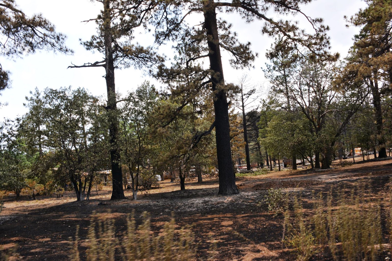
Many of these photos were taken in the same spots for both posts. Pre and Post fire...
There was a fireman posted at this spot and he told us that we were the first civilians he had seen there in several days. They were still mopping up the fire and dealing with hot spots and we should be careful. My camera was sending me telepathic messages to get busy. We didn't see another civilian until we had driven all the way through the fire area. We stopped at the little store in Mt. Laguna and on our return trip we saw several civilians, but still not as many as we expected. This is the longest post I've ever done. I apologize in advance for that...
We had just driven through the little town of Julian and our path took us directly towards the fire. The fire was nine miles outside of town. Our campground is about half way there.
A bit closer! I'm surprised the dead bugs on our windshield didn't show up in these two photos.
We made it to our destination and although there was lots of smoke, the fire was now hidden from us.
Here is the just opened turn off through the fire area. We think the guy in the truck just opened the barricades. This took place three days after we arrived in the area.
Beautiful Sunrise Highway (Ca S-1) to Mt. Laguna. No fire damage yet.
One of the "Helispots" for the fire was on a ranch located in this beautiful valley. It was probably the closest place to safely conduct helicopter operations.
Several miles into the drive we saw this. It is almost the exact view from where our RV is parked, but from a different angle.
This is what is left of the old road which was re-routed to the other side of the hills to the right. On the left side you can see the same monuments in the post from last year. There are plaques on and around it dedicated to hang gliders, some who died there. This path is now part of the Pacific Crest Trail (Mexico to Canada).
They think the fire originated at the bottom of this ravine. I stuck my foot out so you could see just how steep it is.
Just because I liked it
A major rock slide on the old road
The fight goes on in the distance
One of the many Hand Crews we saw in the area.
Another "just because I liked it"
A fireman told me that they believe the fire started where that burnt ground ends in the middle of the photo. It comes to a single point. The prevailing wind blows towards where i was standing, so that is the likely spot.
I took this photo from the Pacific Crest Trail. You can see where it cuts around the top of the burnt mountain top. I'm going to follow the trail for a while.
This is the spot where the trail disappears around the mountain in the previous photo
Around the corner it looks the same and there are more turns to make
Another turn coming up. My goal is to be able to see where we are camped. It's only a few miles and the Pacific Crest Trail goes very close to it.
Starting to see a lot of rock on the trail. I think the heat made some of the rocks crack and fall off.
The trail is now covered with ash and burnt material. I know that it isn't healthy to breath this stuff so, I called it a day. Besides, my wife and granddaughter are probably starting to wonder if I've fallen off of the mountain
Heading back down the trail
Just so you can see the scale of it all. It's a long long way down. I'm no daredevil and don't like heights, but this is becoming a tradition, right?
And again...
Back on the road
A very common sight on our drive
One of the main goals for the firefighters was to keep the fire from jumping the road. Most of the structure damage occurred when it did jump the road, from left to right.
There were 149 structures destroyed in the fire. Many of them in this area.
I have the utmost respect for Firefighters. Especially those who work wildfires. It is brutal, exhausting and extremely dangerous.
This spot is is several miles down the road from where we first stopped. The Pacific Crest Trail is just on the other side of these trees. I don't know what to make of all these fire hoses. Maybe damaged?
Another little hot spot right off the road
The good news is that nobody was seriously injured in this fire!
Last May I did some hiking in this area looking for the remains of an old gold mine town. I didn't know that what was left of it disappeared in an previous fire. I found the place, but not much was left. I did manage to get myself lost though! These things will be the subject of a future post.
.
.