Monday, October 28, 2013

Memorial Peak Trail

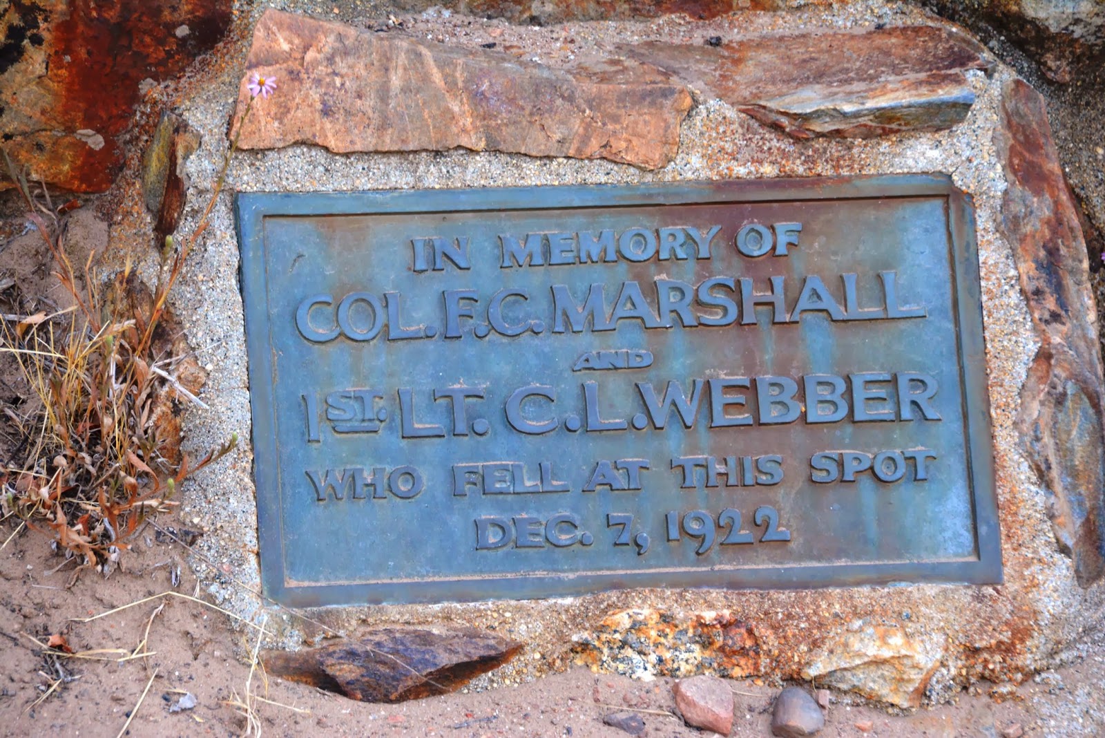
On 12/7/1922, a plane carrying US Army Colonel, Francis Marshall, took off from North Island airbase, in San Diego Harbor for an inspection of army posts in  Arizona. The De Havilland DH-4B, Bi-Plane was piloted by Lt. Colonel Charles Webber. The plane took off in poor weather and didn't make it very far. It crashed near Japacha peak in the Cuyamaca Mountains. Despite the largest military search effort ever (up to that time), the wreck site was not found.  Six months later a local rancher discovered the wreck while rounding up stray cattle. The next year a very small memorial that included the plane engine, was built on the crash site. The airplane was left there for almost 40 years before most of it was removed.

The elevation of the mountain side memorial is 4,800 feet. The trail was steep and it was very hot that day. We made a couple of discoveries on the way up that helped keep us going.

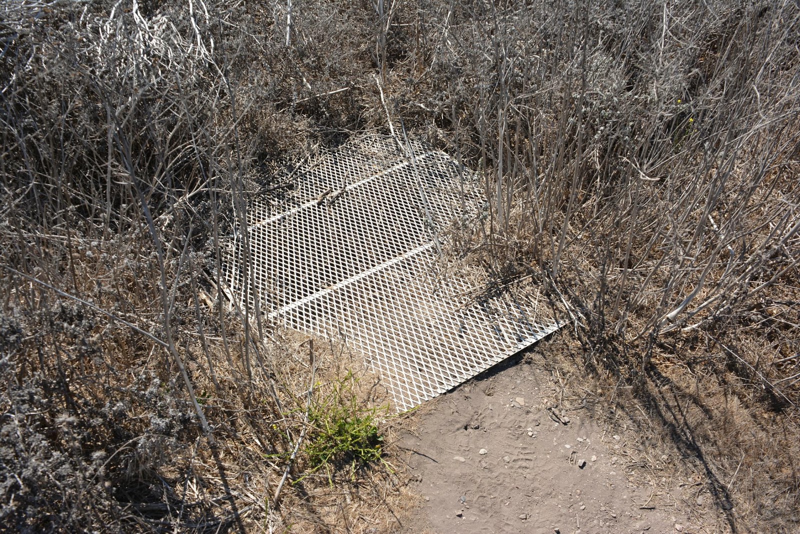
Just a bit overgrown in places. Long pants and sleeves will help you avoid a lot of scratches. Of course we didn't have on either.

My wife leading the way uphill 


 A bit of scenery from the hike

 Maybe the prettiest rock I've ever seen!

A huge remnant of the massive Cedar fire that devastate a large portion of San Diego County and burnt almost 100% of Cuyamaca Rancho State Park. The Cedar fire was the largest fire in modern California history.  Prior to that fire (2003) this was a fairly heavily forested area. You can tell by the photos, that it is that it is recovering, but is nowhere near the way it was.


 Awesome Stonewall Peak 

 High country meadow

 Long ways to go and happy for the shade

 10 year old dead trees everywhere


 Almost there!

 Not near the top, but I like the view


I saw a bit of light shining through the brush and powered my way though to see what it was. What it was (and is) is a couple of morteros. For those who don't know, a mortero or "mortar" was created and used by the local Indians to grind acorns or grain into flour.  It takes many years to make them this deep. The local Kumeyaa Indians spent summers in these mountains and winters in the desert lowlands. This went on for centuries.


Multiple and deep morteros means they were probably used for a very long period of time. So, there are probably other indications of their presence in the area. It could be rock art, artifacts, etc. I'm not sure if this rock has anything on it, but it kind of looks like it to me. There is software that enhances those things and I really need to get it.


Finally, we got to the memorial. It's pretty much just the engine and a little plaque. There are also a few parts laying around. There are bees living in the engine.


Some other parts of the plane are just sitting there. I'm SO VERY happy that  people are finally starting to leave things as they find them. That way others can also enjoy!  Thank goodness ATV's and Quad-Runners couldn't make it up the trail.  I do think that some people on those things are responsible for most of the damage, graffiti, vandalism and theft in historic natural places. That's right, I went there!


For no reason other than I liked the symmetry of the dead trees


Monday, October 21, 2013

Can we Please Talk About Menopause for a Minute?

First off...
I apologize in advance to any of you ladies out there who after reading this, may feel a hormone fueled urge to squeeze my head until it bursts. Apology accepted? Okay then, here we go.  

I've discovered yet another reason that makes me so very darn happy (thank you very much), that I am NOT a woman! My wife wasn't so lucky though. Her menopause appears to be more of a chronic condition rather than something that will pass. 

Either way
I should NOT have to dress
Like I'm about to climb Mount Everest
While sitting in my living room 
In the middle of winter
When it's freezing outside 
With all the windows open
And the air conditioner is on full blast
While my wife is dressed in summer clothes 
And mopping sweat off of her head and neck
While she says things like
"It's so HOT in here!
Over and over and over
While I am dangerously close to frostbite

It's a touchy subject to be sure. Luckily, I've learned a thing or two in our time together. One of them is to quietly slip into my parka and just sit there quietly shivering.

Of course, I wasn't always this smart. I used to say things like "it's not hot at all, it's just you!" Remarks like that were never accepted with open arms by my wife. Not even if I ended the sentence with "honey" or "my love."  Geez!

I'll get back to our travels soon. Right now I just need to know something.

Is it just me?


.


Monday, October 14, 2013

Last Yuma Arizona Post for 2013

Tomorrow morning we are heading out to the desert for a couple of weeks. We're going to Joshua Tree National Park. I know what you're thinking.  "It's a National Park, dummy! They are all closed."  Of course those of you thinking that are right. However, we hope the whole shutdown thing will be worked out soon. If it's not, there is still plenty to see out there. 
-------------------------
Okay, now back to today's post!
I know I said I was done with posts from Yuma this year, but how about just one more. This may be the last Yuma post for 2013, but it's also a teaser of things to come in 2014. We're a few months away and I already have an agenda of things I want to see. So bear with me, umkay?

   Laguna Dam
Believe it or not, this was the first dam built across the mighty Colorado River. It was basically an earthen dam  built to control flooding. This is the place that caused a bunch of controversy because of all the swastikas imprinted in the concrete structures. Some of you will remember it. It was just about the oddest thing we've run into in our travels. If you haven't see this and you have a minute or two, check it out.

This looks like a standard photo of some old stuff, right?  Not really...There is so much history both in the photo and where I was standing when I took it. The bridge in front is a very old and an important railroad bridge crossing the Colorado River. The white bridge behind it, is mega-famous. It's called the Ocean-to Ocean bridge and was the first auto bridge across the Colorado. Before it was built, if you wanted to go east, you had to travel about a thousand miles for to go around the river. The white structure in far right is also a famous place. To top it all off, I took this photo while visiting the Yuma Territorial Prison. After we return there in early 2014 and I take some more photos of each of these things, I'll do another post.

The next three photos were taken in old Yuma. These are the only photos I have of it. That will change in a few months. It looks pretty interesting there.


No shortage of trains in the desert.

Just because I thought it was pretty.

People like to shoot at old signs, right? Well, this one is inside the city limits! Did I mention that a high percentage of folks in Arizona carry weapons? 

Okay, this time I promise! This is the last post relating to Yuma this year.


.


.


Monday, October 7, 2013

Spooner's Cove - California Central Coast

A couple of weeks ago we spent some time on the central California coast. One day we were looking for a place called Los Osos Oaks (The Bears Oaks) to do some hiking. As sometimes happens, the trail-head wasn't where our GPS said it was supposed to be. So we kept driving.


Instead of what we were looking for, we saw this. We both love the ocean, so we quickly forgot about our hike through the forest.


This photo was taken in front of the white building in the left side of the above photo.  Apparently, we had entered Montana de Oro (Mountain of Gold) State Park without knowing it. I'd heard of the place, but knew nothing about it. Anyway, this old wooden building (now a little museum) was once the ranch house for the 7,000 acre Spooner Ranch. This photo also shows the north side of Spooner's Cove. There is a lot of other history associated with this place, but I think this is enough for now.


Here is the southern side of Spooner's Cove.

This is the right side of the cove again. A lady working in the ranch house told me that there was a major archaeology dig on top of the hill. I saw a trail going up that way and knew we'd be checking it out. The lady then said that there was nothing left up there. Too bad! We settled for sniffing out some sea glass on the beach.


A nice little natural arch.

I'm sure that dog was supposed to be on a leash, or maybe not there at all. Still, it made for a nice photo.

You can see the ranch house on the very left hand side of the photo. That sharp point jutting out into the cove (on the left), is the end of the south side of Spooner's Cove (from the third photo).  The ranch (and now the park) has over six miles of ocean front. Most of it consisting of beautiful and rugged coves.


The scene in the last photo, was directly behind me.  This is the foundation of a storage building that was used to store crops, lumber and sheep products over a hundred years ago.


before being dropped in this gravity chute, which ended at a freight loading area for...


The ships that would dock at the edge of this rocky outcropping.


I was only being stupid here to show you how steep and far down it was to the ships. The actual trail is about 10 yards behind me.

A photo of the cove from way back in the day.
I'll shut up for a while now.


We found a way down into this one.


Each of these layers was the sea floor at some time in the distant past.


For those who have heard of it, that is Morro Rock in the distance (in front of the mountains)


This part of the trail is roped off, but that doesn't stop some people! Like my wife...


If you are ever in this area, I strongly advise you to come and see this place. There are also many great hiking trails in the area.


.